
- Official return
- 3.6 miles / 5.8 km
- Trail
- Forney Ridge from Kuwohi arrival area
Two routes share an arrival area, not a purpose
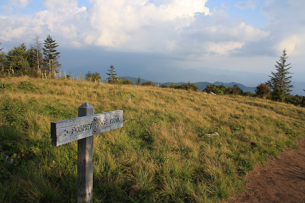
For Andrews Bald, take Forney Ridge Trailhead on the left just before the Kuwohi visitor information centre, as identified by NPS. The paved path continuing towards the observation tower is a different route. The bald outing is 3.6 miles return through spruce-fir forest with stairs and an uphill finish; the tower outing is one mile return on a steep paved climb. Choose the bald for a longer forest-to-opening journey, and the tower for the structure and a shorter high viewpoint visit. This is a choice between different surfaces and effort patterns, not two halves of one small loop.
Older descriptions may use Clingmans Dome for the Kuwohi area. Treat that as a naming reference within the same geographical planning, not as evidence of another trailhead to collect. Use the current official map to identify the Forney Ridge start and the selected return. A correct starting branch matters more than a general instruction to walk from the parking area.
The descent comes before the climb
The NPS describes a descending approach through high-elevation spruce-fir forest, with stairs and a transition from a broader early section to narrower dirt path. That sequence makes the route more varied than a simple paved viewpoint approach. It also means the outward walk does not represent the hardest effort pattern of the whole outing. The same return must climb back to the start.
The dedicated official description lists 3.6 miles return. Choose it with the uphill finish in mind, particularly if somebody is attracted by the modest mileage. A group can enjoy the descent and still find the later climb more than it wanted. Discuss that before departure rather than let the openness of the destination create pressure to stay until all the return margin has been used.
Forest and bald are both the experience
The transition from enclosed spruce-fir forest to the more open bald gives the walk a coherent subject. Notice the change in light, vegetation, and visible distance as the route reaches the opening. The destination is not only a platform for a mountain photograph. Its relationship with the surrounding forest explains why the approach is worth walking rather than treating it as access to one view.
Use established trail and appropriate visitor positions in the opening. Grassy ground is not permission to create new routes through vegetation or seek every possible foreground. A small number of careful observation stops can show the setting well. The full return remains part of the day, so keep the destination visit enjoyable without letting it become an indefinite session that leaves the uphill finish rushed.
Do not make flowers or distant visibility a promise
Andrews Bald is associated with seasonal flowering and mountain views, but neither should be guaranteed for a particular visit. Natural timing and visibility change. Choose the walk for the forest-to-opening journey and accept flowers or a broad clear horizon as possible additions. That creates a more dependable reason for the outing than a photograph whose conditions may not occur.
For photography, include the vegetation and landscape actually present rather than search for a scene beyond the intended route. If cloud limits distance, the contrast between the opening and forest may still make an interesting subject. If flowers are limited, notice texture and shape instead. The route does not lose all value because one seasonal feature differs from an online image.
Keep the turnaround at the planned destination
The Forney Ridge trail system extends beyond a casual visit to the bald. Identify the selected endpoint on the official map and return as planned rather than keep descending because the next section looks inviting. Every extra outward step also belongs to the return. A downhill-first route is particularly vulnerable to this kind of gradual expansion because the effort feels deferred until later.
A group should agree whether the bald is the whole hike before leaving. If somebody wants a larger route, assess it independently with its complete profile and finish. The short bald return is a legitimate mountain outing by itself. It does not need an added summit, tower, or farther ridge to be worth choosing.
Compare the tower before combining the two
Kuwohi's tower route is shorter but steep and paved. Andrews Bald is longer, with forest surfaces, stairs, and an uphill return. These differences mean that one is not automatically easier for every visitor. Someone who dislikes a steep paved climb may prefer a different terrain pattern, while someone who dislikes uneven ground may not want the bald route. Compare the actual demands instead of ranking by distance alone.
Doing both can make sense when the group wants both experiences and has allowed their complete effort. It should not be assumed because the arrival area is shared. If Andrews Bald is the main walk, keep the tower optional after the return rather than promise it regardless of energy. A single chosen outing with time to observe often makes a clearer day than two routes linked only by parking proximity.
The final access decision remains current
Check NPS access and trail cautions near travel, including the actual route from your starting area. This guide does not give a road-opening guarantee or current surface report. Its stable recommendation is to choose the Forney Ridge branch knowingly, enjoy the forest-to-bald transition, and reserve enough time and energy for the climb back. That makes the outing a complete decision rather than a pleasant descent with an unexpected ending.
Questions answered
Is Andrews Bald the tower trail?
No. It uses Forney Ridge Trail from the Kuwohi arrival area, while the tower has a separate route.
Why should we plan around the return?
The approach descends, so the return climbs back. Judge the complete profile rather than the easier-feeling outward direction.
Should the tower be included automatically?
No. Compare its different steep paved character and make it optional unless both complete outings are deliberately chosen.
Sources & scope
Route facts are drawn from the resources below. The comparisons and recommendations are our research-based editorial analysis; this is not a claim of personal trail inspection. Access and conditions must be checked with the responsible land manager before travel.
Editorial standards · Explore the destination guides
Found a detail that needs correcting? Send the guide URL and a supporting source so we can review the exact route version.