
A linear walk with a simple geography
Elterwater and Skelwith Bridge are connected by a walking line through the lower Langdale landscape. The National Park describes it within the Miles Without Stiles collection, but the useful planning definition is linear: walk from one endpoint to the other, then either retrace the route or make a separately planned onward journey. There is no automatic circular return hidden in the name.
An out-and-back is a strong choice here because the river, lake and woodland create a sequence worth seeing from both directions. You do not need to invent a larger loop to make the journey complete. Keep the named start in Elterwater and the turning destination at Skelwith Bridge. If your accommodation lies elsewhere, add the connection explicitly rather than assuming that a published route distance already begins at your door.
The route’s name identifies two settlements rather than a summit or a complete lake perimeter. Keep those two named endpoints on the same map so that a tempting branch toward another Langdale path does not silently redefine the outing.
The return is about four kilometres in the route description
The national park’s written description defines this outing as about two kilometres each way, or four kilometres for the Elterwater–Skelwith Bridge return. Its page also displays a separate mapped-distance field; do not treat that field as a clearly explained complete out-and-back total. The written scope is the useful comparison here: lake-only turnaround is shorter, Skelwith Bridge return includes both directions, and the New Dungeon Ghyll combination is a substantially larger valley excursion.
The start follows Great Langdale Beck
The official route leaves the Elterwater starting area beside Great Langdale Beck. The first landscape is therefore a river corridor rather than an immediate lake circuit. This matters if you have selected the outing from a photograph of still water: the variety comes from moving between river, lake edge and woodland, not from walking continuously around Elterwater.
The park describes a broad stone path whose slab surface can feel bumpy. That is useful information for anybody choosing the walk because of its access classification. A broad line with no stile is not necessarily a uniformly smooth line. Treat the stated grading and terrain notes together. They explain the intended route more precisely than a general claim that it is an easy valley walk. Surface requirements should be checked against the whole path, including the connections beyond the lake.
Elterwater is a stage, not the full destination
The route reaches the lake landscape after its river approach. Reeds, wooded margins and changing bays give this section a different character from an open reservoir shore. The lake can be a satisfying partial goal if a shorter outing is intended, but that is a deliberate turnaround rather than completion of the full Elterwater–Skelwith route.
After the water, the official line continues through woodland and meadow. That progression helps explain why the route does not look identical in both directions. Returning toward Elterwater, the lake is encountered after the woodland rather than before it. An out-and-back can therefore produce a varied day without needing a second route. Give the changes time to register instead of treating the outward leg merely as travel toward a café or road junction at the end.
Bridge, falls and village are separate features
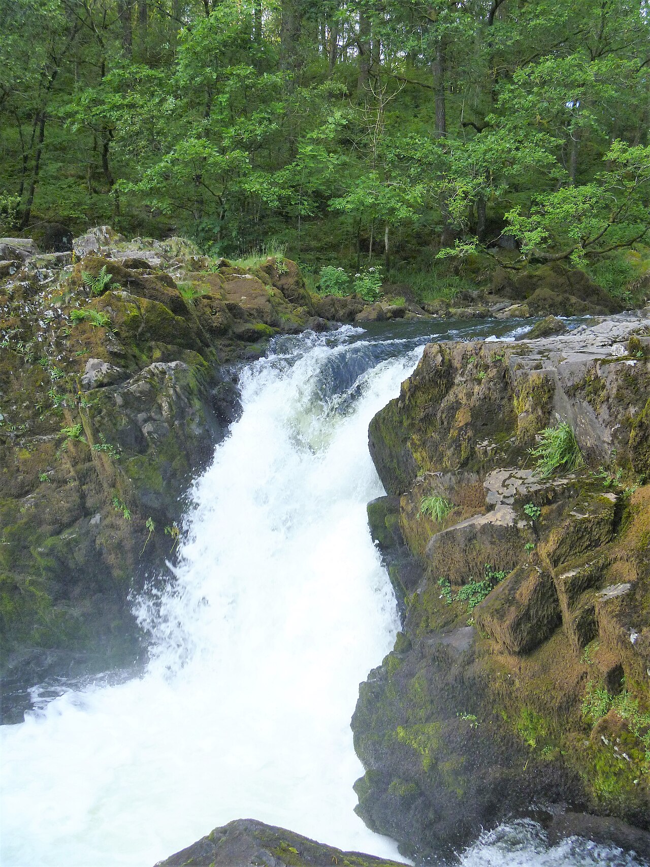
Woodburn Bridge and the Skelwith Force area mark the lower part of the walking sequence before Skelwith Bridge village. They are related but not interchangeable names. Reaching a waterfall viewpoint does not necessarily mean you have reached the route’s named endpoint, and reaching the village does not make a water-edge detour part of the official path.
The practical decision is to remain on the established walking line and enjoy the falls from its designated perspective. This keeps the route focused on the corridor it was designed to use rather than searching for an informal approach into the gorge. The path and viewpoints are enough to understand the landscape. A route guide should help you distinguish these landmarks so that the final stretch and turning point remain clear, not encourage an unplanned water-side exploration.
Keep extensions at the right scale
The national park links this outing with a longer upper-valley route toward New Dungeon Ghyll. That is useful evidence of a wider walking network, but it should not be read as a small addition to a short lower-valley stroll. Connecting both sections and returning produces a much larger journey. The change is geographical as well as numerical: the outing extends from the lower water-and-woodland corridor into the upper Langdale valley.
Choose the Elterwater–Skelwith return when the main interest is a compact sequence of river, lake and falls. Choose the longer valley traverse only when that entire journey is the day’s objective and its return has been resolved. Do not select the shorter route’s description and the longer route’s endpoints at the same time. A clear, modest plan can provide a more attentive experience of Elterwater than a larger outing assembled simply because two route pages mention that they connect.
The outflow landscape also makes the direction of travel worth noticing. Walking toward Skelwith follows the story of water leaving the lake and becoming more confined; returning reverses that sequence toward the broader reedy shore. This gives a simple return walk its own narrative variety.
Questions answered
Does the published distance always mean the full return?
Check the convention in the individual record. The walking day must include every segment you intend to retrace from Skelwith Bridge to Elterwater, plus any separate approach to the starting point.
Can I finish at the lake instead?
Yes, if a shorter return walk is what you want. Treat that as a different endpoint and calculate its route rather than describing it as the full Skelwith Bridge outing.
Sources & scope
Route facts are drawn from the resources below. The comparisons and recommendations are our research-based editorial analysis; this is not a claim of personal trail inspection. Access and conditions must be checked with the responsible land manager before travel.
- Lake District National Park: Elterwater to Skelwith Bridge
- Lake District National Park: route grading
- Visit Lake District: lower-valley route perspective
Editorial standards · Explore the destination guides
Found a detail that needs correcting? Send the guide URL and a supporting source so we can review the exact route version.