
The start controls the scale
Gummer’s How rises above the southern Windermere landscape. A compact walk can begin from the upper forestry-area access, while a longer outing can approach from the lake side. These are different journeys. The summit name is shared, but the amount of approach walking and climbing is not. This is the first detail to settle when comparing guides that appear to disagree about the route’s length.
The forestry land-management record identifies the upper starting area as a common access point while noting that the summit itself lies beyond the forest land. That relationship is useful: a wooded parking or access area does not mean that the entire walk remains a forest track. The outing leaves the enclosed approach and moves toward an open hill. Choose it as a small fell day, not as a level water-side stroll.
Name the upper access and keep the lower approach separate
The upper access is associated with Astley’s Plantation, above the Fell Foot side of southern Windermere. Windermere Lake Cruises’ published walk separates its direct Fell Foot approach from a longer forest approach through Chapel House Plantation. The direct route includes a road climb before reaching the summit footpath; the forest option adds its own wider connection. Neither should inherit the distance of a compact outing beginning at the upper access.
The operator estimates roughly 45 minutes for the summit-footpath return from the upper road, including a brief viewpoint pause, versus approximately one and a half hours for its direct Fell Foot return and three hours for its forest approach-and-return option. These are source estimates for those defined versions, not personal completion targets. Choose the upper version for a focused hill visit; choose Fell Foot only when the lower-to-upper journey itself is part of the intended walk.
An upper start still leaves an ascent
Beginning higher reduces the approach from the lake but does not place you on the summit. The path rises from the access side toward the hill’s upper ground. Steps and rock are part of the ordinary character described in walking accounts, so a short distance should not be translated into a promise of a smooth surface. The meaningful assessment is whether that particular ground fits the party.
This is a different decision from choosing a lakeshore park. A visitor who wants water-level walking may enjoy the panorama from Gummer’s How but still prefer a route without the hill’s upper terrain. Conversely, someone seeking a compact climb can value the change from woodland to open view. Be precise about that preference. The route does not need to be sold as universally easy to be a worthwhile candidate for a short walking window.
Read the upper landscape without chasing every path
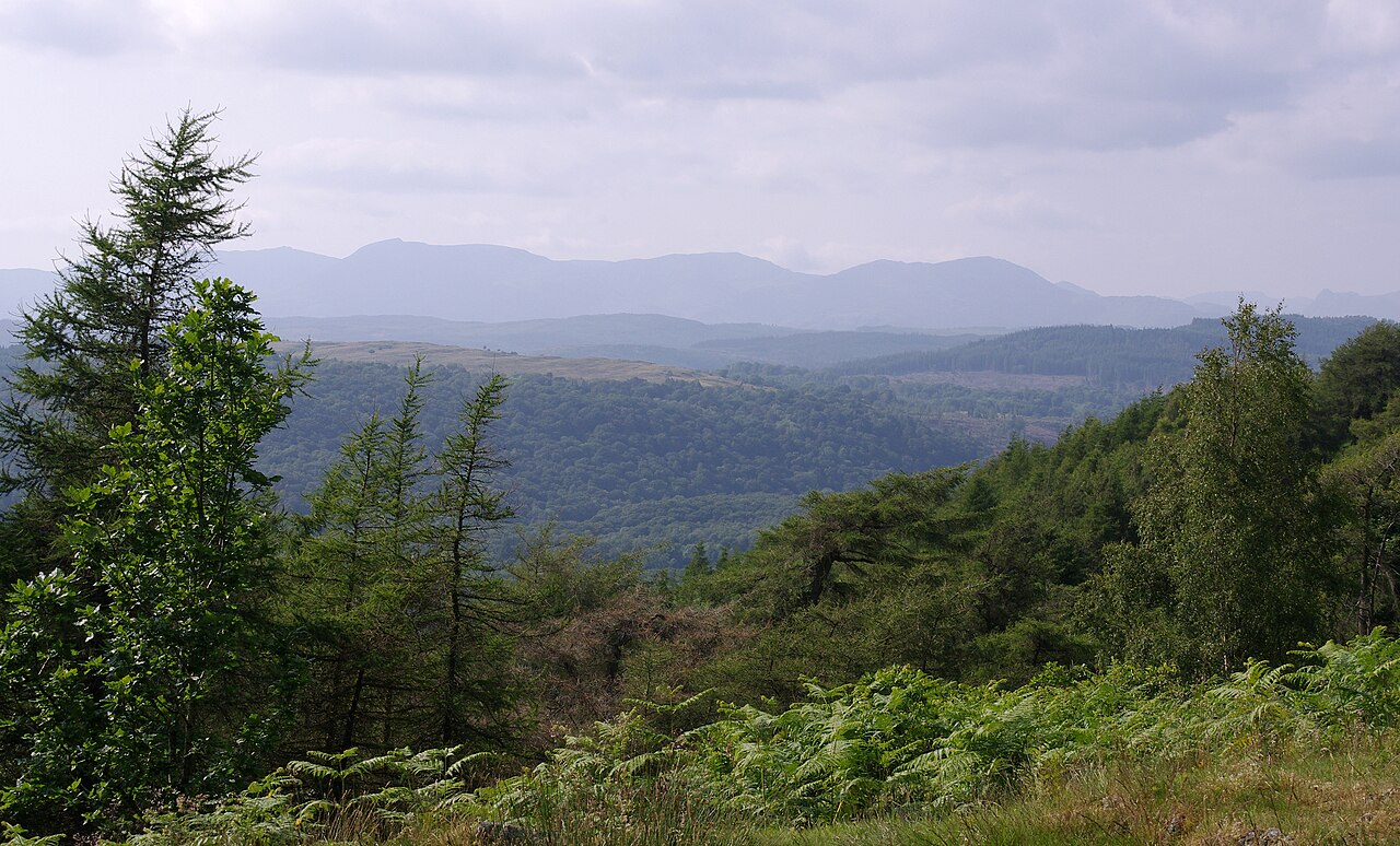
The main attraction is the view over the southern end of Windermere and the surrounding lower landscape. It gives a perspective different from the lake’s northern mountain setting. Water, wooded slopes and the direction toward the estuary country become more legible from above. That is enough purpose for the outing without adding another summit or trying to trace every visible path across the hill.
Use a complete mapped walking route for the chosen approach and return. This guide does not describe techniques for climbing rocky alternatives or recommend making an informal line to a photograph. The upper ground should be assessed through the established route, with the decision made before the group is standing beside a feature that looks more demanding than expected. A viewpoint walk succeeds when its ground and endpoint match the plan, not when every rock has been climbed.
Keep the descent attached to the selected route
A compact summit outing is usually planned with a return to the same upper starting area. Reversing the approach can make the route clear, but the descent still crosses the ground used to climb. A short rocky section does not vanish once the panorama has been enjoyed. If a different return is desired, it needs to be a mapped route rather than an attractive-looking way down the open slope.
The upper start also needs to remain distinct from any lake-side travel arrangement. Finishing beside the forestry area is not the finish of an outing that began farther below. Count the remaining walking connection and understand its surface and road relationship. This is a practical reason to avoid borrowing a distance without its start definition. The summit may be identical, but the homeward journey can be substantially different.
A separate lake visit can be better than a forced combination
Fell Foot and the southern Windermere shore can provide another kind of experience: water-level views and a landscaped lakeside setting rather than an open-hill ascent. They can be visited on the same broader travel day if the connections and time genuinely work, but the two should not be presented as one continuous short summit route by default. The transfer between them is part of the itinerary.
Choose the hill when the elevated perspective is the main interest and its terrain suits the group. Choose the shore when proximity to water and a lower setting are the priority. If both matter, plan them as two defined components rather than one vague Gummer’s How afternoon. That simple separation makes the route lengths honest, avoids accidental extra climbing and lets each landscape be appreciated for what it actually offers. The southern lakes do not need a complicated summit checklist to provide a varied day.
For visitors already staying near southern Windermere, the hill can offer a different perspective without moving the holiday’s base north. That is a geographic advantage, not proof that every south-lake accommodation lies beside the upper start. Plot the exact connection before deciding how compact the day really is.
Questions answered
Does a short Gummer’s How distance include the climb from the lake?
Not necessarily. Many compact descriptions assume an upper-road start. A lakeshore approach is a separate connection that must be included in the full route.
Is the hill the same experience as Fell Foot?
No. Gummer’s How provides an elevated fell outing; Fell Foot relates to the water-level park landscape. Treat a combined visit as two itinerary components.
Can I assume a forest start means a smooth forest trail throughout?
No. The summit lies beyond the forestry access landscape, and the upper ground has a different character.
Sources & scope
Route facts are drawn from the resources below. The comparisons and recommendations are our research-based editorial analysis; this is not a claim of personal trail inspection. Access and conditions must be checked with the responsible land manager before travel.
- Forestry England: Chapel House land-management and access geography
- Windermere Lake Cruises: Gummer’s How walking approach
- Lake District National Park: southern lakes landscape
Editorial standards · Explore the destination guides
Found a detail that needs correcting? Send the guide URL and a supporting source so we can review the exact route version.