
- Official return
- 4.3 miles / 6.9 km
- Approach
- Gabes Mountain Trail near Cosby Picnic Area
Select the Gabes Mountain approach
Use the designated hiker parking at Cosby Picnic Area near the campground entrance. NPS directs walkers to backtrack about 100 yards along the entrance road to the signed Gabes Mountain Trail start. This small road connector is part of the outing and prevents the mistake of taking an unrelated campground path. Follow Gabes Mountain for the defined Hen Wallow waterfall visit and return by the researched line; the broader trail continues beyond the falls towards other forest objectives. Choose this start deliberately rather than navigating only to a waterfall pin or assuming every Cosby trail begins at the same place.
This guide concerns the defined waterfall return, not the full Gabes Mountain Trail or a larger connection. A named trail can continue well beyond the destination chosen by day walkers. State that scope before departure so a sign beyond the falls does not become a surprise request for more walking. The waterfall provides a complete objective with its own forest approach and return.
The forest trail still includes climbing decisions
The dedicated NPS route lists 4.3 miles return and notes steep sections, switchbacks, and roots. Those details should govern the decision more than a photograph of the waterfall. A wooded setting can feel inviting while still asking for careful attention and a sustained return. Choose the hike when the whole route fits the group's preferences, not as an automatic easy substitute for another waterfall.
Compare the complete profile with a recent outing on similar ground. Somebody may be comfortable with the distance but dislike repeated roots, while another may prefer uneven forest to a steep paved climb. These differences are useful information rather than obstacles to talk someone out of. A route is appropriate when its actual features match the people walking it.
The waterfall's shape supplies a distinct subject
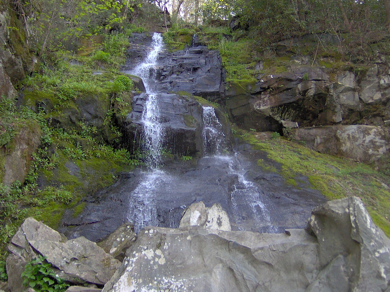
Hen Wallow is described by the park as a waterfall that begins narrowly and fans outward as it descends. That form gives the endpoint a different visual character from a single clean vertical drop. Observe the relationship between water, rock, and surrounding forest from appropriate established positions. A contextual image can explain the shape without moving closer to the water.
This article does not direct visitors into the pool, onto wet rocks, or to an unofficial base position. The waterfall is a viewing destination within a walking outing. Its attractiveness does not create a separate activity beyond the route. If the flow or light differs from a remembered photograph, work with the actual scene rather than expand the visit in search of a more dramatic angle.
Give the approach its own observation time
The NPS identifies hardwood forest with hemlock and rhododendron along the route. Notice how the path moves through that setting instead of regarding it as empty distance before the falls. Changes in enclosure, sound, and the visible creek can make the journey coherent even without a broad mountain panorama. This is a forest-waterfall day, not a summit hike with water added at the end.
For a group, choose stopping places that leave room for others and keep the walking rhythm comfortable. A slower pace can be part of the purpose if the return time has been allowed for. The route should not become rushed because several additional Cosby objectives were promised before anyone understood how much attention the main outing would invite.
An onward old-growth walk is a separate scope
The official description notes old-growth forest farther along Gabes Mountain Trail. That possibility is not automatically included in the waterfall outing's published distance. If the extended forest walk is a priority, research its complete route and return independently. Do not continue simply because the next section sounds attractive after the named destination has been reached.
For a group interested mainly in old-growth structure, Albright Grove provides another distinct Cosby-area option to compare. Its small internal loop has a substantial approach, so it is not a casual addition either. The choice should be between complete journeys and subjects: Hen Wallow's waterfall landscape or a dedicated forest destination. Sharing a region does not mean both belong in one day.
Compare Ramsey without reducing the decision to fame
Ramsey Cascades is a more substantial Greenbrier-area ascent with a changing old-road and upper rocky character. Hen Wallow offers a different route and geographical center. A visitor wanting a less extensive waterfall day can investigate Hen Wallow, but should still assess its steep and uneven sections rather than assume that shorter means universally easy. The best alternative changes the demand that does not fit.
If your base and other plans favor Cosby, Hen Wallow can organize a coherent day without a transfer to another region merely to see a better-known waterfall. Choose the landscape you want and give it time. A single well-selected hike often provides more value than comparing several falls hurriedly from the end of an overfilled itinerary.
Keep the return as clear as the destination
Retrace the researched route from the waterfall area, preserving enough time for the same roots and steeper portions encountered outward. Confirm current official cautions and access before travel; this guide does not promise a dry surface or seasonal passability. Its lasting advice is to use the correct Gabes Mountain start, choose the waterfall scope, and keep any onward forest ambition separate. That creates a practical Cosby outing with a distinct purpose and an understood finish.
Questions answered
Does the trail begin on any Cosby campground path?
Use the signed Gabes Mountain Trail start identified in official route information. Other Cosby paths serve different outings.
Is the route free of steep sections?
No. The dedicated description includes steep portions, switchbacks, and roots despite the moderate return distance.
Is the farther old-growth section included automatically?
No. It is an extension requiring a separate complete plan beyond the defined waterfall return.
Sources & scope
Route facts are drawn from the resources below. The comparisons and recommendations are our research-based editorial analysis; this is not a claim of personal trail inspection. Access and conditions must be checked with the responsible land manager before travel.
Editorial standards · Explore the destination guides
Found a detail that needs correcting? Send the guide URL and a supporting source so we can review the exact route version.