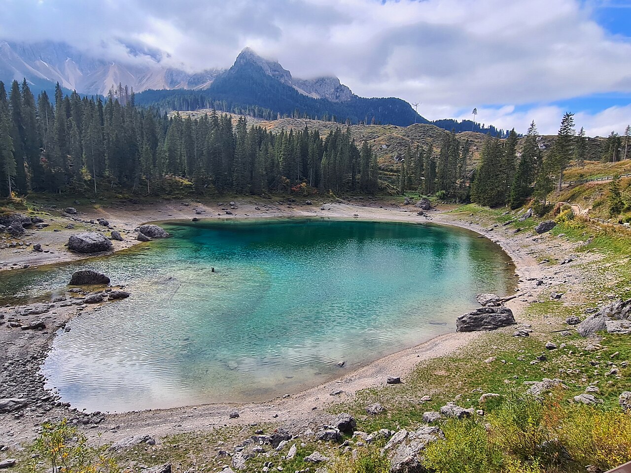

Select the shore or the forest circuit
Lago di Carezza can be experienced as a focused shore visit or as part of a longer woodland walk. Those are different scopes. This guide uses the official green-sign middle circular route when discussing the forest extension. The named route is2.7kilometres in the Eggental tourism description. Do not attach that figure to every possible lake-and-forest combination, because the immediate shore circuit and additional longer variants create different totals.
The useful choice is whether you want time mainly beside the lake or a walking day that uses forest to place the water in context. Both are worthwhile. A short lake visit does not become more authentic simply by adding kilometres. Conversely, somebody who enjoys the approach and return may find the woodland option much more satisfying than a brief stop at the best-known view.
What the green-sign route adds
The middle route begins from the lake arrival area, crosses the suspension bridge and uses a forest approach before returning towards the lake. Official directions connect paths6and10 and include a road crossing near the named settlement reference. Keep the map and full route page together. The numbers identify a specific forest loop rather than every path visible around Carezza.
The bridge and trees give the walk a different rhythm from the shore circuit. Instead of remaining within one lakeside scene, you move through the surrounding setting and return to the water with a stronger sense of place. That is the reason to choose the extension. It should not be promoted as a secret route to an unrestricted part of the lake or a way to reach a hidden photography position.
The boundary is part of understanding Carezza
Carezza is a protected natural monument, and the official information emphasises respecting the marked protective boundary. Remain on the established paths and viewing areas. Do not cross the barrier because a reflection looks clearer from the water's edge. The barrier is not an obstacle to the advertised photograph; it marks the relationship visitors are expected to have with the lake.
A genuine photograph can be made from legitimate viewing ground. The composition may include the boundary or other visitors, but that is not a reason to enter a protected area. Choose a position along the authorised route and let the changing angle supply variation. This guide recommends no swimming, shoreline scrambling or unofficial access.
A lake that changes should not be sold as one image
Official local information explains that underground springs influence the lake and that its dimensions vary with season and conditions. That matters more than an exact colour promise. Water level, wind and light can make your view different from a widely shared photograph. A visit is more resilient when the wider combination of forest, water and Latemar setting interests you, rather than only a specific reflection.
The woodland loop can help in that sense because it makes the visit a sequence of experiences. You still should not choose it simply to compensate if the lake does not look like an image. Decide whether the walk's ground and length fit the group beforehand. A different water level does not justify expanding the route impulsively or crossing a boundary to reach the scene you expected.
Three scopes to keep separate
The larger Latemar options should not be folded into a gentle lake-walk description. Some involve rougher terrain and different requirements. If that landscape interests you, research the exact route independently. Carezza itself and the middle forest circuit already provide a coherent outing without an obligatory mountain addition.
Swipe the table horizontally to compare every column.
| Choice | Purpose | What changes |
|---|---|---|
| Immediate lake circuit | A focused shore-and-viewing-area visit | Less woodland walking |
| Green-sign middle circuit | A defined forest extension returning towards Carezza | Bridge, road crossing and a larger total |
| A longer Latemar or labyrinth outing | A separate mountain-and-rock landscape journey | Different terrain and commitment, not a simple lake extension |
A road crossing deserves an explicit place in the plan
The woodland route is not a continuous lakeside footpath insulated from the surrounding settlement and road. Read the official directions for the crossing and use the indicated pedestrian arrangements. For a group expecting only a natural shore stroll, that detail changes the experience. It is one reason a route page should explain the complete line rather than show only a lake photograph and a walking-time estimate.
For individual mobility needs, use current detailed official access information. Do not extend an accessible claim about a viewing platform or shore area to every forest path nearby. A shared destination does not establish identical surfaces, gradients or crossings. Choose the actual route that matches the need, not the broadest reassuring description attached to the place name.
How to use Carezza within a wider trip
Choose the shore visit for a modest water-focused break; choose the middle circuit when you want a longer forest component as the main local walk. Count the full arrival and onward journey if the visit falls on a transfer day. Avoid combining a series of individually short lake stops until there is no time to enjoy any of them. One carefully chosen walk can give more value than several repeated arrival photographs.
Verify current local route notices and access information before going. This guide intentionally omits parking rates, facility hours and live conditions. Its lasting recommendation is to keep the lake boundary respected, the forest-loop scope explicit and the expected image flexible. That makes the real Carezza landscape, rather than a guaranteed photographic effect, the reason for the visit.
Questions answered
Is the middle forest route the same as the shore circuit?
No. The official green-sign middle route is a separate2.7km forest loop, with a lake-circuit addition described as optional. Keep the chosen scope explicit.
May I cross the barrier for a better lake photograph?
No. Follow the protected boundary and use established paths and viewing areas.
Sources & scope
Route facts are drawn from the resources below. The comparisons and recommendations are our research-based editorial analysis; this is not a claim of personal trail inspection. Access and conditions must be checked with the responsible land manager before travel.
- Eggental tourism: official middle circular route
- Eggental tourism: lake protection and visitor information
Editorial standards · Explore the destination guides
Found a detail that needs correcting? Send the guide URL and a supporting source so we can review the exact route version.