
Choose the area's purpose first
Yosemite is easier to plan as several walking areas rather than one collection of trail names. The National Park Service organizes its hiking information that way, and the structure solves a real visitor problem: routes that look close on a park-wide map can belong to very different days. Begin by choosing the landscape you want and the amount of climbing the group wants to do. Then select a route within the appropriate area.
For a first visit, Yosemite Valley is the clearest center for mixing modest walks with optional major ascents. Wawona supports a southern-park day combining a different forest setting with sequoia choices. Glacier Point and the Tioga Road areas introduce higher starting points and their own terrain questions. Hetch Hetchy is a separate reservoir-and-granite landscape. You do not need every area in one short visit to experience variety.
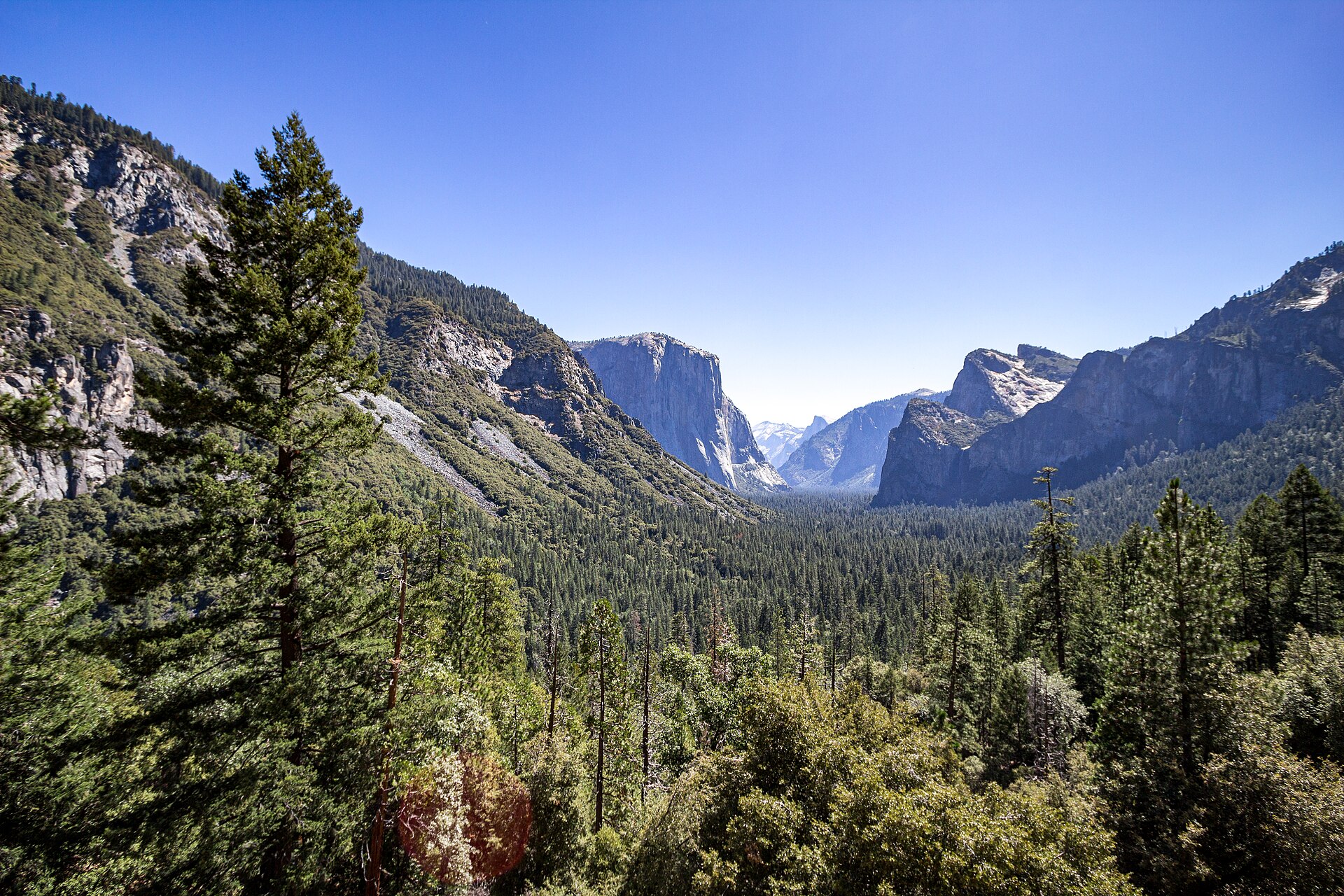
Yosemite Valley: the most flexible starting menu
Cook's Meadow provides a compact broad-view circuit, while Lower Yosemite Fall approaches a close waterfall setting. Mirror Lake gives a canyon perspective with a choice between a shorter return and a longer circuit. These routes make a coherent introduction because they answer different interests without requiring a summit. Choose two complementary experiences rather than assume that every easy walk must fit into the same day.
For a substantial ascent, compare Upper Yosemite Fall, Four Mile Trail, and the Nevada Fall outing as alternatives. Upper Yosemite Fall is closely connected with the north-side waterfall landscape; Four Mile climbs toward Glacier Point with changing panoramas; Nevada Fall provides a staged river-and-waterfall journey from Happy Isles. Select one as a main day. Their shared fame does not make several large climbs a sensible default for a first short visit.
Wawona: choose forest, sequoias, or a major waterfall day
Wawona Meadow offers a longer mostly level forest-edge circuit, and the Wawona Swinging Bridge is a short defined river walk. Mariposa Grove has its own route choices: Big Trees Loop for a compact introduction, Grizzly Giant Loop for a named-tree circuit, and Wawona Point for a longer grove-and-overlook day. Decide which scale you want before reaching the Arrival Area, and resolve current access to that starting point separately.
Chilnualna Falls is the area's substantial waterfall ascent. It should replace a longer grove hike in the day's effort budget, not be appended to one because both appear in southern Yosemite. For a less strenuous forest-centered day, choose the Grizzly Giant circuit and a modest Wawona activity. For a dedicated waterfall climbing day, choose Chilnualna and preserve the return time. That distinction turns a vague southern-park list into two usable plans.
Glacier Point corridor: compare the endpoints
Sentinel Dome and Taft Point share a starting area but provide different final settings. The dome has open granite terrain and a broad viewpoint; Taft Point approaches the valley rim and fissures. Choose the one whose terrain and experience suit the group. The linked circuit is a separate larger outing, not automatically included in either short-return description. Glacier Point's designated overlook is another choice for a more direct viewpoint visit.
McGurk Meadow offers a different subject: a modest forest descent toward a meadow and historic cabin, with climbing on return. It can add variety when the group has already spent time looking at broad panoramas. A selected Panorama Trail return toward an Illilouette Fall view is a different downhill-first outing whose climb back must be explicit. Do not let a high starting point suggest that every nearby walk is effortless.
Tioga Road and Crane Flat: choose the actual start
May Lake is a compact high-country climb when measured from its designated upper starting area; added access-road walking changes the outing. Lukens Lake has a short Tioga Road approach and a separate longer White Wolf option. These distinctions matter more than the general label lake hike. Choose one complete route and verify the start rather than combine figures from several accounts.
Near Crane Flat, Tuolumne Grove and Merced Grove provide smaller sequoia outings with downhill approaches and uphill returns. Tuolumne Grove is not Tuolumne Meadows, despite the shared name. This is a useful geographical correction when planning a first trip. A grove visit near Crane Flat may fit naturally into one route through the park, while Mariposa Grove creates a different southern-day plan. Choose by the complete day from your base.
Hetch Hetchy: a separate reservoir day
The Wapama Falls route begins with the dam and tunnel before following a rolling shoreline path. It provides a landscape distinct from Yosemite Valley, but the waterfall objective and bridge area require current official guidance. Do not treat crossing every section as a compulsory achievement. The longer Rancheria route is a separate commitment rather than an extra added because a sign points onward.
Choose Hetch Hetchy when that reservoir-and-granite setting is a main interest and the separate access fits the visit. It is less useful as an afterthought squeezed behind a major valley ascent. A geographically focused day gives you time to understand the area instead of spending the visit trying to preserve a timetable assembled from distant attractions.
Choose the base by the two days you will repeat
A base becomes useful when it supports the days you actually want, not simply when it appears near a park entrance. If your priorities are a Cook's Meadow orientation and a Happy Isles waterfall hike, repeated valley access should organize the stay. If your priorities are Mariposa Grove and a Wawona walking day, the southern geography deserves more weight. Make those two decisions before comparing exact accommodation locations, then trace the real approach and return from each candidate.
For a short visit, one base often keeps the itinerary clearer than several moves. A move is worth evaluating when it solves repeated journeys for several priority days, not merely when it gets you closer to one optional short trail. Include packing, arrival arrangements, and the evening after a long hike in the comparison. The end of the walking day matters as much as the morning start. A convenient-looking location loses its advantage if the final connection remains unresolved.
If you will not have a car, use the exact accommodation address and confirmed transport links rather than a broad Yosemite-area label. A valley-centered menu can still provide meadow, waterfall, and canyon variety. A higher-road excursion belongs only after its actual start and return are confirmed. The trip should follow connections that work, rather than imitate a driving itinerary with its vehicle silently removed.
Turn a trail name into a complete outing
For each selected hike, write four things together: the actual start, the named endpoint, the return line, and the approach from your base. This exposes the assumptions that a short description can hide. May Lake's compact figure assumes its designated upper starting area. A Mariposa Grove circuit is measured from the Arrival Area. Four Mile Trail reaches a road-accessible destination but still needs a return plan. None of these details is solved by saving a map pin for the scenic endpoint.
Next, distinguish a published one-way figure from a return or circuit measurement. The historic Four Mile name is not the current route distance, and the two direct-return descriptions for Sentinel Dome and Taft Point do not measure their linked circuit. The Valley Loop also appears in different official route geometries, so use one current map with its matching description. The goal is not perfect arithmetic from incompatible sources; it is a clear definition of the route you intend to walk.
Finally, decide what will happen if the selected endpoint no longer fits the day. A planned Columbia Rock outing, a Vernal Footbridge return, or a shorter Mirror Lake visit can each be complete. They should not be presented as failures to reach a more famous destination. A shorter choice is most satisfying when its own purpose is clear before anybody starts.
Use three concrete trip profiles to narrow the menu
For a visitor wanting familiar landscapes with modest walking, start with the valley. Cook's Meadow explains the broad arrangement, Lower Yosemite Fall brings one waterfall close, and the shorter Mirror Lake return introduces a canyon. Select the actual connections and allow time for interpretation and photographs. There is no need to add a rim ascent merely to make the trip feel active. The three settings already differ in scale and subject.
For a group wanting one substantial climb, preserve that as a primary day. Compare Nevada Fall's staged water landscape, Four Mile Trail's panorama-focused ascent, and Upper Yosemite Fall's north-side route. Choose one according to the journey, then use gentler contrasting outings around it. A capable group may be able to do more, but ability alone does not make several similar climbing days the most varied use of a short visit.
For a forest-focused visit, choose one sequoia grove and a distinct companion subject. Mariposa Grove fits a southern day with Wawona geography; Tuolumne or Merced Grove fits the Crane Flat area when the uphill return is appropriate. A meadow or river walk can add more contrast than another grove. If comparing sequoia settings is a particular interest, a second grove becomes a deliberate research choice rather than a compulsory completion task.
Plan photography around the route you chose
A scenic objective can quietly change a walking plan if the photograph becomes more important than the route boundary. At waterfalls, the maintained viewing area is the destination, not the beginning of a search among nearby rocks. At Taft Point, the rim landscape can be understood without an edge pose. At a grove, protected ground around a trunk is not empty foreground waiting for a person. State these boundaries as part of the visit rather than wait until someone wants a closer angle.
Allocate stopping time according to the subject. Cook's Meadow invites comparison between several broad views, while a grove rewards attention to the forest around individual trees. Mirror Lake may present meadow and sand instead of the reflection somebody expected. A photograph of the actual landscape can still explain the place well. Do not let a missing reflection, reduced waterfall, or obscured sightline turn an otherwise appropriate outing into an unplanned detour.
For a mixed-interest group, agree that photography is one way of observing rather than a reason for everyone else to wait indefinitely. Choose a few useful stops on legitimate parts of the route and leave room for other visitors. This improves the day's rhythm and keeps the return from being squeezed by a long session at the endpoint.
Keep permanent choices and departure checks in separate notes
The permanent part of the plan explains why you chose the area and route: its landscape, effort pattern, exact endpoint, and complete return. The departure note covers the current facts that can change, including access, restrictions, weather, and relevant services. Separating them prevents an evergreen article from being mistaken for a live authorization. It also makes updating the actual trip easier because you know which assumption each new piece of official information affects.
A fallback should be another researched outing with its own clear purpose. If a higher-area lake plan no longer fits, a valley landscape day may be useful when its conditions and routes are appropriate. Do not assume lower elevation alone settles the matter. If a waterfall route is unsuitable, a grove or interpretation-focused day may provide a different subject rather than a weaker imitation of the original goal. Changing the activity is sometimes more coherent than searching for the closest available trail.
The final result should be a small set of complete days that you can explain without vague phrases such as explore nearby. Each day has an actual walking center, a principal route, a return, and one optional addition that can disappear. That level of specificity gives a first visit room to change while keeping its purpose intact.
A concrete way to combine the choices
For a varied first sequence, begin with Cook's Meadow and a selected Lower Yosemite Fall visit to learn the valley's scale. Make a second day the group's chosen main ascent, such as Nevada Fall or Four Mile Trail, with its complete return already resolved. Give a third day to a different subject: a Mariposa Grove circuit, a high-country lake outing, or one Glacier Point-corridor walk. Choose the third area's access and terrain according to current official information and the group, not a fixed calendar promise.
This is a selection framework rather than a claim that every route will be available on every date. It resolves the key decisions: modest orientation, one deliberate larger objective, then a contrasting landscape. If the group prefers no major climbs, replace the ascent day with the defined Mirror Lake return and another valley-floor activity. A first Yosemite hiking trip is successful when the walking fits the people and the places, not when every famous name appears in the itinerary.
Questions answered
Do I need a major summit hike on a first visit?
No. Valley-floor loops, a canyon walk, and a grove visit can form a varied hiking trip without a rim ascent.
Which major valley hike should I choose?
Compare the route's subject and full return: Upper Yosemite Fall for its waterfall landscape, Four Mile for the Glacier Point ascent, and Nevada Fall for a staged river-and-waterfall day.
Should I include every walking area?
Not on a short visit. Select one geographical center per day and favor distinct experiences over a list of distant names.
Sources & scope
Route facts are drawn from the resources below. The comparisons and recommendations are our research-based editorial analysis; this is not a claim of personal trail inspection. Access and conditions must be checked with the responsible land manager before travel.
- NPS: Yosemite hiking areas
- NPS: Valley route choices
- NPS: Southern Yosemite routes
- NPS: High-country lake and grove routes
- NPS: Hetch Hetchy routes
Editorial standards · Explore the destination guides
Found a detail that needs correcting? Send the guide URL and a supporting source so we can review the exact route version.