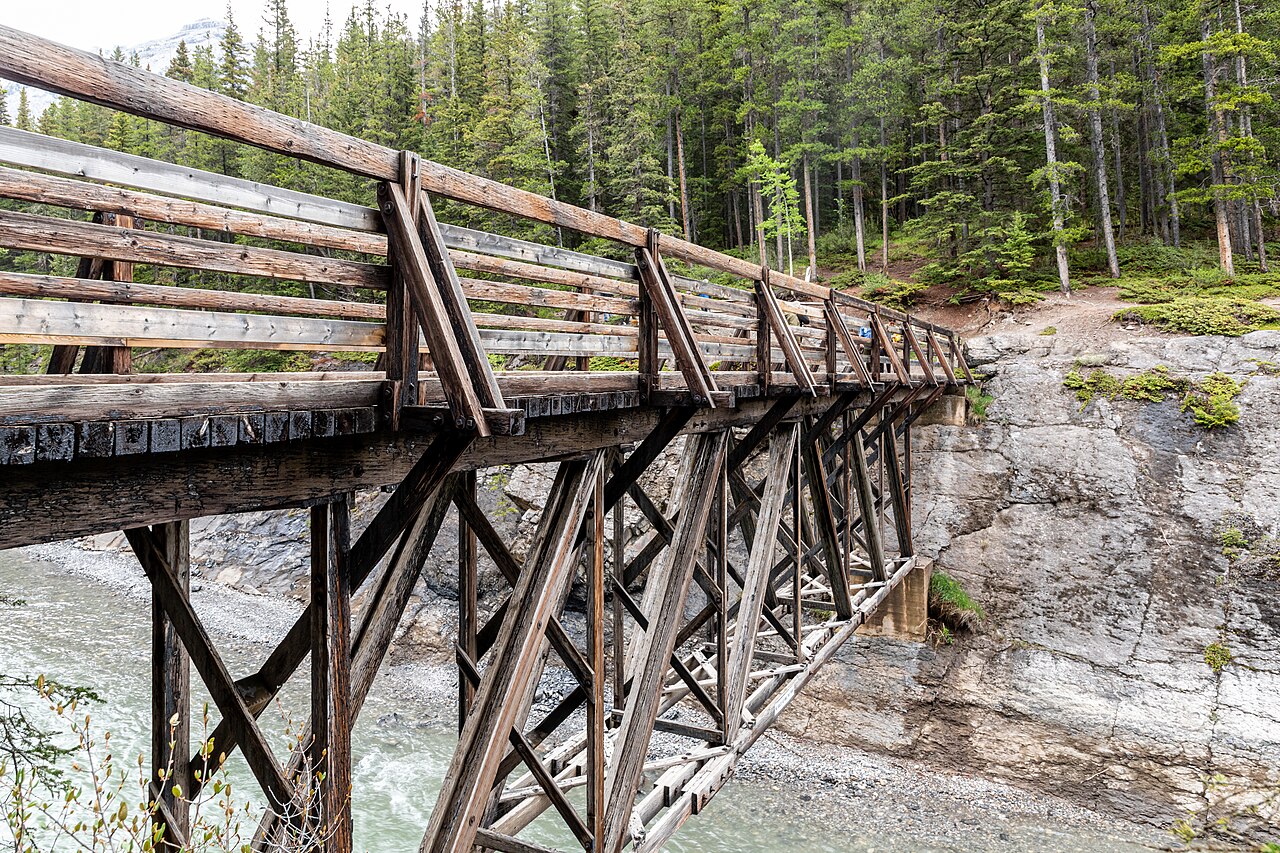

Use the bridge as the day’s clear objective
The Stewart Canyon outing begins in the Lake Minnewanka day-use area and follows the shoreline towards the bridge over the canyon. That bridge gives a short walk a defined purpose: the lake setting changes into the narrower channel cut by the Cascade River. You do not need to continue along the wider lakeshore trail system to make the day complete. The canyon is the selected destination rather than merely the first landmark in an indefinite walk.
This distinction prevents a common planning error. Searches for Lake Minnewanka trail may produce a much longer lakeshore journey, lookout approaches or backcountry itineraries. Those are not alternate names for the short bridge outing. Save Stewart Canyon as the specific objective, locate its turn-back point on a map and retain the same finish at the day-use area.
The developed start is only one phase
The early approach passes through the developed day-use setting before the natural trail becomes more prominent. Parks Canada's detailed information notes rougher rock-and-root ground and some exposure beyond the initial portion. A comfortable beginning therefore cannot establish that the whole route has the same surface. If uneven ground or narrow places affect your group, assess that full description before deciding.
The useful question is not whether the route is short, but whether the combination of distance and ground fits the people walking. A person who enjoys natural shore paths may find the variety appealing; someone seeking a uniform promenade may prefer another independently assessed outing. Do not infer accessibility from the existence of facilities at the starting area.
Lake and canyon supply contrasting rewards
The shore approach opens the landscape across the lake, while the bridge focuses attention on the river channel and canyon walls. That contrast makes the modest outing interesting without a summit climb. It is a good choice to investigate if you want a definite endpoint and a changing water landscape. Johnson Lake supplies another water-focused experience, but its organising feature is a full circuit rather than a canyon destination.
Spend time noticing where the scene narrows and how moving water relates to the wider lake. The bridge is a viewing position on the route, not an invitation to descend into the channel. Remain on appropriate established ground. A photograph taken beside water outside the path cannot tell you the circumstances of access or whether that position belongs in your outing.
Stewart, Johnson or a longer Minnewanka day?
The short bridge outing is particularly useful when you want a lighter day with a destination. A longer route may be rewarding, but its location beyond the same starting area does not make it a casual extension. The farther objective must justify its own complete plan.
Swipe the table horizontally to compare every column.
| Plan | Best reason to choose it | Boundary to retain |
|---|---|---|
| Stewart Canyon bridge out-and-back | A short lake-to-canyon progression | Return from the selected bridge objective |
| Johnson Lake circuit | Changing views around an entire small lake | Complete the assessed mixture of shore surfaces |
| Longer Minnewanka lakeshore route | A more extensive journey along the lake | Its own distance, terrain and current restrictions |
| Aylmer area objective | A substantial viewpoint or pass day | A different mountain itinerary entirely |
Why continuing can change more than distance
Longer lakeshore travel can introduce different exposure, wildlife restrictions and return commitments. Do not assume that a rule or condition relevant to one section applies identically everywhere, or that a route's attractive beginning establishes the suitability of its entire length. Use current official information for the actual scope. This guide does not reproduce seasonal wildlife rules or imply permission to continue beyond the chosen short outing.
A clear endpoint also helps mixed groups. Agree the bridge-and-return plan before departure so that a stronger walker does not gradually redefine the day through a sequence of small extensions. If you genuinely want a longer Minnewanka outing, research it as the main activity of a different day. Both plans can be worthwhile without one being framed as a lesser achievement.
Fit the walk into a Minnewanka-area visit
Stewart Canyon can be the walking anchor of a relaxed lake visit. Allow time to enjoy the wider day-use setting without automatically adding another complete hike. Travel, stops and photographs take real time. A list containing several short lake walks can become a busy circuit with little space to appreciate any of them. Choose the combination because its experiences contrast, not simply because the road map connects their starting points.
If using a fixed onward arrangement, leave a comfortable margin for the whole out-and-back. The bridge is not a one-way finish with an assumed pickup. Your route returns to its starting area. Keeping that shape obvious is more useful than quoting a bare one-way distance without context.
The decision that remains useful year after year
Consult current Parks Canada trail information and relevant notices before choosing the outing. This page does not provide live access, transport or canyon-water conditions. Short routes remain outdoor routes, and the developed start does not eliminate variability along the shore. If the natural ground is not appropriate for your group on the day, choose a different assessed plan rather than seeking a shortcut.
The lasting recommendation is to use Stewart Canyon for its specific transition from broad lake to narrow river channel. Count the complete return, understand the rougher section beyond the start and keep the longer Minnewanka system outside the day unless you deliberately planned that different journey.
For the Stewart Canyon bridge outing, the directory gives 1.6 kilometres one way, 30 metres of ascent and 10 metres of descent, with a one-hour return estimate. Retracing that line is 3.2 kilometres. This is the scale to compare with Johnson Lake's 2.9-kilometre loop: similar broad walking amounts, but one has a bridge destination and repeats its shore approach, while the other completes a circuit. Choose by that experience and the actual ground, rather than assuming either is simply the shortest way to fill time at Minnewanka. A farther lakeshore objective cannot use the bridge outing's figures.
Questions answered
Is Stewart Canyon the entire Lake Minnewanka lakeshore hike?
No. This guide ends at the canyon bridge and returns. The longer lakeshore system needs its own route assessment.
Does the developed starting area mean the whole route is smooth?
No. Official detailed information identifies rock-and-root sections and some exposure beyond the initial developed approach.
Sources & scope
Route facts are drawn from the resources below. The comparisons and recommendations are our research-based editorial analysis; this is not a claim of personal trail inspection. Access and conditions must be checked with the responsible land manager before travel.
- Parks Canada: Stewart Canyon trail details
- Official tourism: Minnewanka and the Cascade River setting
Editorial standards · Explore the destination guides
Found a detail that needs correcting? Send the guide URL and a supporting source so we can review the exact route version.