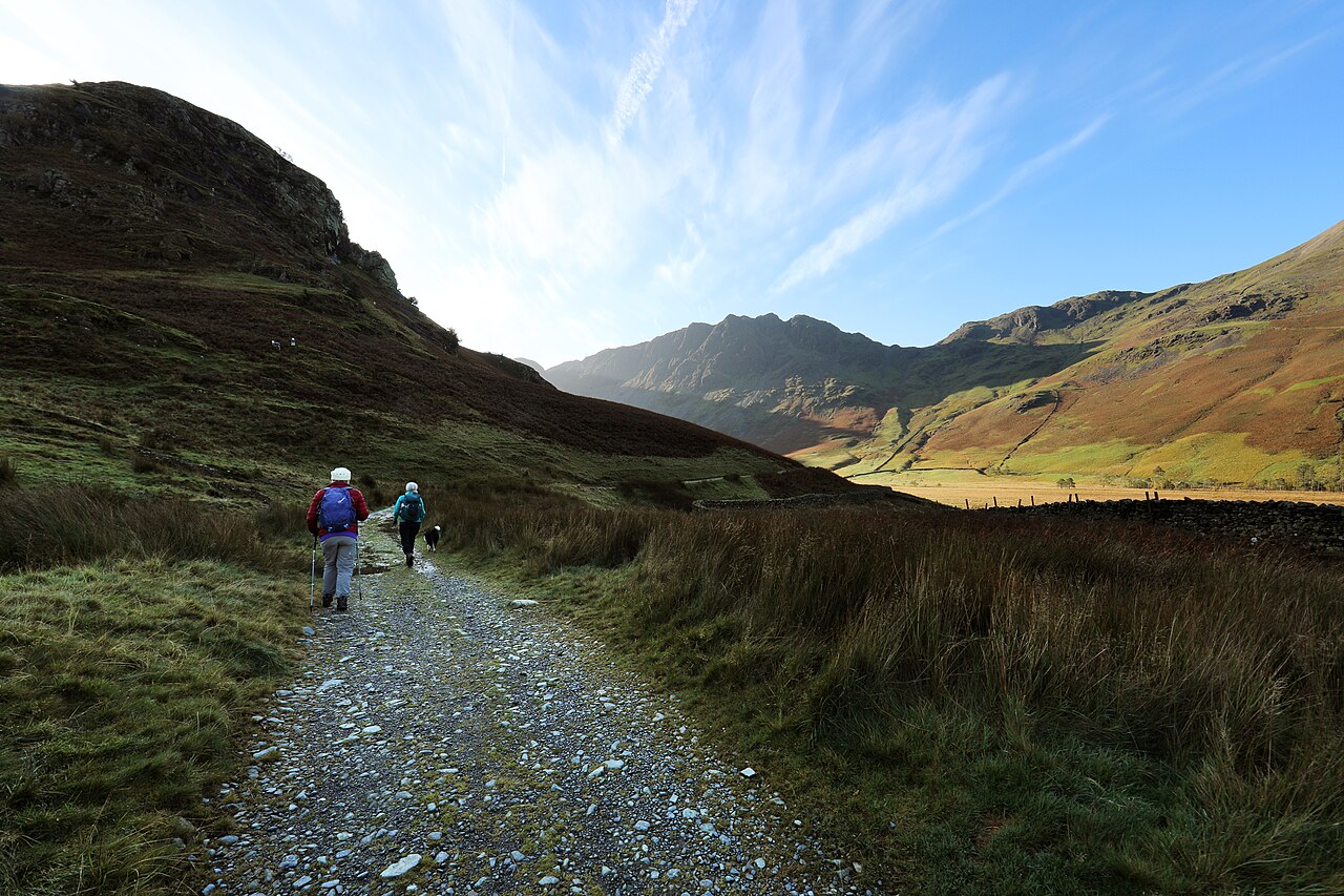

Keep Gatesgarth and Buttermere village separate
Gatesgarth lies toward the head of the Buttermere landscape, while the village is at another part of the lake. A Haystacks route beginning at one is not simply another measurement of a route beginning at the other. The regional tourism authority publishes a larger village-start circuit that includes additional shore and connecting walking. This guide concentrates on the Gatesgarth relationship with Scarth Gap and the upper fell.
The difference matters because the lake can make the geography look compact. A route that includes a substantial shore connection may still be described by the same summit name as a shorter ascent. Before comparing mileage, identify whether the published line begins at Gatesgarth, the village or another access point. Then decide whether the return retraces Scarth Gap or completes a different circuit through Warnscale. The summit alone is not a route definition.
Scarth Gap is a pass, not the summit
The approach toward Scarth Gap uses an established route rising from the valley. Reaching the pass provides a clear geographical stage, but it does not finish the Haystacks ascent. The route then leaves the pass line for the rocky upper fell. This is the principal change in ground and commitment that a short description can obscure.
Do not treat the pass approach’s character as a promise about the final section. A familiar-looking track can lead to a rougher mountain path, and the upper ground contains rock rather than a single smooth ridge. The planning question is whether that experience is what the party wants. This article assesses the choice; it does not provide scrambling techniques or encourage an improvised line across crags. Use the established mapped route and appropriate route-specific guidance when selecting the day.
The tarn landscape is part of the high-level journey
Haystacks is known not only for a high point but for the relationship between rocks, small waters and neighbouring mountains. Innominate Tarn and Blackbeck Tarn appear within the larger upper circuit described by the regional tourism route. They are not both automatically included in every compact summit return. If seeing them is a priority, select a route whose complete line reaches them and resolves the descent.
This upper landscape can make progress less linear than the view from below suggests. Rather than one summit and an obvious drop back to the valley, the walking can move among rocky features and intervening ground. Allow attention for that route structure. A plan designed only around the moment of reaching the highest point can underestimate the rest of the chosen circuit. The small waters deserve time, but their inclusion must remain attached to a coherent walking line.
Retracing Scarth Gap versus returning through Warnscale
An out-and-back through Scarth Gap revisits the ascent ground. Its advantage is a clear route relationship; its cost is negotiating the rocky upper section again in the opposite direction. A Warnscale circuit adds variety and a different view of the fell, but it also adds another line through the upper landscape and a separate descent. Neither is automatically the easier choice for every walker.
Select the circuit because its complete sequence is desired, not because loops are assumed to be better. Understand the return through Warnscale and the connection back to Gatesgarth before using the route. A village-start version may then add more walking beyond that point. Keep those scales separate. A route can be compact relative to surrounding mountain rounds while still requiring sustained concentration on its own rough ground.
Do not turn nearby summits into unpriced extras
The surrounding skyline contains other attractive objectives, but a Haystacks day does not require adding them. A continuation toward another fell changes distance, ascent and descent geography. It should be chosen from a complete route account rather than appended because the next ridge looks close. The focused Haystacks outing is already distinct from a Buttermere shore day or Rannerdale ridge circuit.
For a stay in the valley, that distinction is useful. Choose the lake for a water-level landscape, Rannerdale for a different compact ridge experience, and Haystacks when its rocky upper world is the intended goal. Each deserves an honest terrain assessment. The strongest Gatesgarth plan states its pass approach, upper objective and return in advance. It lets the place’s rocks and tarns provide the interest without turning the day into a larger summit checklist whose final route was never resolved.
On the upper route, Innominate Tarn is a specific named feature rather than a general description of every small pool. Keep those names attached to the mapped line so that photographs and route notes do not quietly substitute one water or hollow for another.
Questions answered
Does reaching Scarth Gap mean I am almost finished?
It completes a stage of the ascent, but the rocky upper route and the full return remain. Assess those separately rather than borrowing the pass approach’s character.
Are Innominate Tarn and Blackbeck Tarn on every version?
No. Their inclusion depends on the selected upper route. A compact retraced ascent and a larger tarn-and-Warnscale circuit are different outings.
Can the village circuit’s mileage describe my Gatesgarth walk?
Only after comparing the full line. The village version adds connections that a Gatesgarth-start outing may not include.
Sources & scope
Route facts are drawn from the resources below. The comparisons and recommendations are our research-based editorial analysis; this is not a claim of personal trail inspection. Access and conditions must be checked with the responsible land manager before travel.
- Visit Lake District: Haystacks route and upper sequence
- Visit Lake District: Gatesgarth ascent context
- National Trust: Buttermere walking landscape
Editorial standards · Explore the destination guides
Found a detail that needs correcting? Send the guide URL and a supporting source so we can review the exact route version.