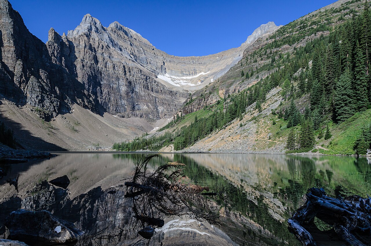

- Current official one-way listing
- 3.9 km; 495 m ascent and 80 m descent for the approach
Choose the climb for the lake
Lake Agnes is often introduced through its tea house, but the stronger reason to choose the trail is the transition from Lake Louise into a higher lake setting. You begin with the large, public waterfront and spend much of the approach gaining height through forest. The destination then provides a different, more contained waterside landscape. That progression makes sense even if you do not buy anything or find the building operating. Treat refreshments as a possible addition, not the reason the walking plan works.
The route also provides a useful middle choice between the Lake Louise Lakeshore and the higher Beehive viewpoints. The shore walk prioritises water-level views with less climbing ambition. Agnes makes ascent and a second lake the purpose of the day. The Beehives add a further viewpoint objective beyond that arrival. Choosing Agnes alone is not doing an incomplete version of a more impressive hike; it is selecting a different balance of effort and reward.
Read the current route figures consistently
Parks Canada's current hiking directory lists the Lake Agnes approach as 3.9 kilometres one way, with 495 metres of ascent and 80 metres of descent. These are route figures, not simply the height difference between two lakes. Older brochures and some other descriptions give different totals. For your route card, use one identified current official itinerary rather than choosing the smallest number from several pages. Mixing an older distance with a newer climbing figure creates a combination that no source actually describes.
For an out-and-back, allow for the full return as well as the climb. Descending the approach is not free time, and it may feel different to walkers who prefer climbing to walking downhill. If your group wants a relaxed day, leave room for time at Agnes and do not judge the outing only by a published moving-time estimate. The important question is whether the complete day suits your demonstrated walking ability.
Mirror Lake has a job in the route
Mirror Lake is a named landmark on the forest approach, not an alternative name for Agnes. It helps make the progression understandable: Lake Louise is the start, Mirror Lake is an intermediate place, and Lake Agnes is the selected destination. Retain those names with a map so that a tempting path to another viewpoint is not mistaken for an obligatory continuation. A succession of attractive junctions is exactly where an unplanned outing can become longer than expected.
Use the intermediate stop to reassess the shared plan without turning it into a competitive checkpoint. If the climb is already more demanding than the group expected, a shorter outing can be the right result. If everyone feels comfortable, continue with the originally chosen destination. The existence of a higher objective does not mean you must decide on it while standing at a junction. Major extensions are better selected with the complete map before the day begins.
Agnes, Big Beehive and Little Beehive are separate choices
Do not choose between the Beehives only by their names. Little does not mean effortless, and Big does not mean compulsory. Both require their own route assessment and add to the Lake Louise approach. If this is your first significant walk of the holiday, Lake Agnes alone provides a clearer measure of how the group feels before committing to a later, larger day.
Swipe the table horizontally to compare every column.
| Objective | Primary reward | Reason to choose it |
|---|---|---|
| Lake Agnes | A mountain-lake arrival after a forest climb | You want a complete lake-to-lake outing |
| Big Beehive via Agnes | A higher view looking down towards Louise | You deliberately want the additional climb and descent |
| Little Beehive | A different elevated viewpoint above the area | The viewpoint, rather than another lake stop, is central to the plan |
Keep the lake pause independent of a queue
A plan built entirely around sitting at a tea house can become frustrating if arrangements differ from what you expected. Carry what you need for the walk and regard the lake setting as the dependable purpose of the outing. Choose an appropriate established place for a pause without blocking the path or entering protected vegetation. Your lunch break can still be rewarding without depending on a table, a particular menu or a social-media photograph.
Likewise, give the shoreline its own attention rather than immediately asking which peak comes next. The tighter basin at Agnes changes the sense of scale from the broad Lake Louise waterfront. Looking across the water and noticing the relation between forest, rock and lake is part of the experience you climbed for. A day that contains ascent, a long pause and an unhurried return can be more memorable than a larger route experienced under pressure.
An itinerary that ends where it began
For this guide's scope, return to Lake Louise by the planned approach. A connection towards Plain of Six Glaciers creates a different circuit and should be researched as such. Do not borrow an estimated time for the Agnes out-and-back and use it for a combined tea-house route. A loop that seems efficient on a map may contain additional climbing and terrain that the shorter description never included.
Before travel, verify the official trail report, mountain forecast and any restrictions. High-lake access should not be inferred from conditions at the lower waterfront. This page does not promise a snow-free date or tea-house availability. It solves the enduring choice: Agnes is a good objective when you want a sustained forest ascent and a second lake, with the return and any extensions deliberately kept within your plan.
Questions answered
Do I need to hike a Beehive after Lake Agnes?
No. Agnes is a complete destination. A Beehive adds a higher viewpoint and extra effort; choose it because you want that separate objective.
Which Lake Agnes distance should I use?
Use the current official itinerary that matches your start and finish. Do not combine older brochure figures and newer route data, and distinguish ascent from net height difference.
Sources & scope
Route facts are drawn from the resources below. The comparisons and recommendations are our research-based editorial analysis; this is not a claim of personal trail inspection. Access and conditions must be checked with the responsible land manager before travel.
Editorial standards · Explore the destination guides
Found a detail that needs correcting? Send the guide URL and a supporting source so we can review the exact route version.