
- Official listed distance
- 2.3 km one way; return along the same shore route
Walk the lake, not a circuit around it
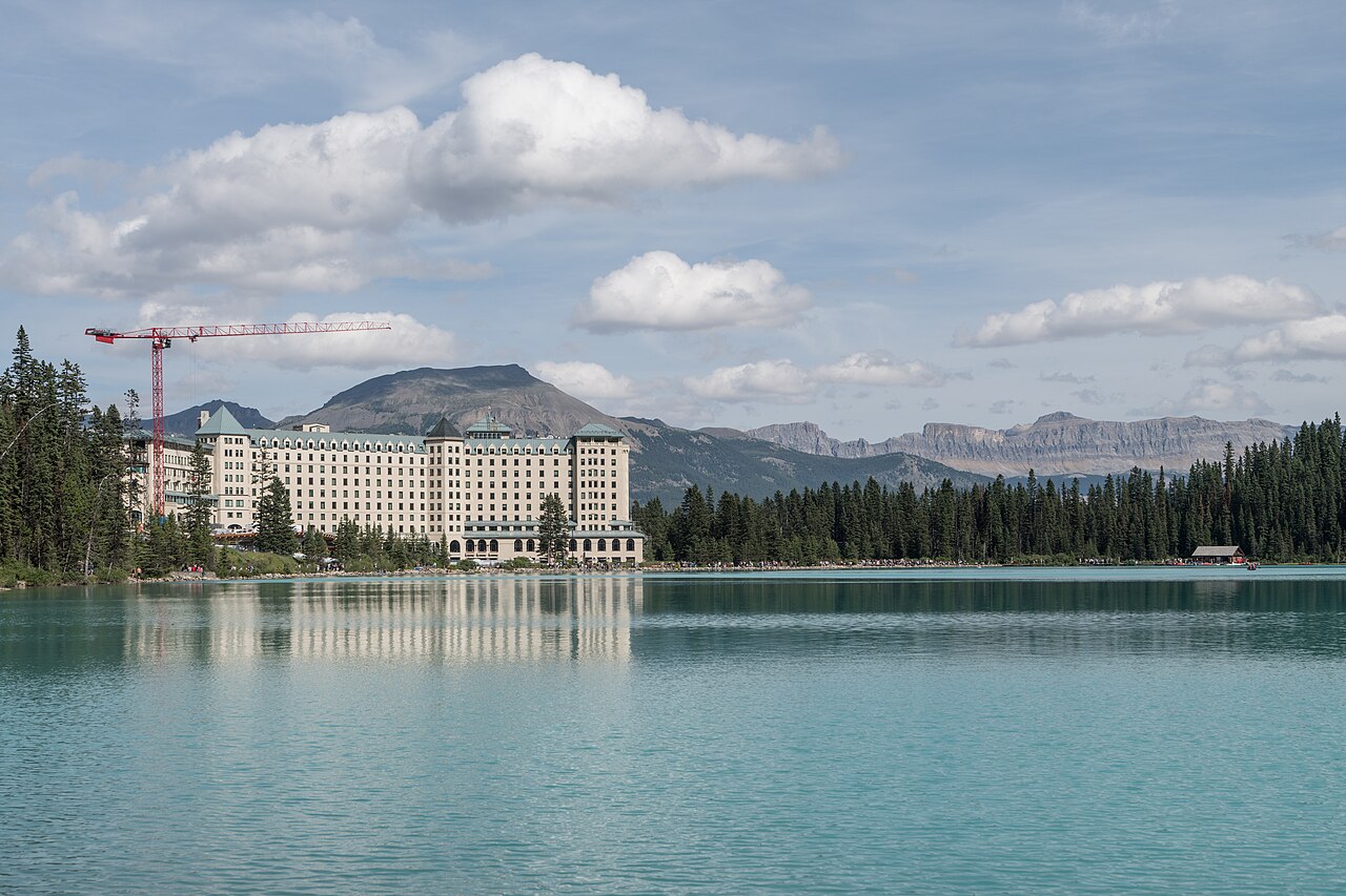
The Lake Louise Lakeshore Trail gives you a sustained experience beside the water, but it does not make a complete circuit. Plan to walk along the established shore path and return by the same route. That distinction solves the first planning problem: you are choosing how far to travel along a lake, not committing to a loop whose far side will eventually bring you back. An apparent line along another bank on a photograph is not evidence of an authorised connecting path.
The return is part of the experience rather than wasted repetition. On the outward walk, the head of the valley and its mountain setting draw your attention. On the return, the view back towards the Chateau and the lake's arrival end gives a different sense of scale. If you photograph only from the main waterfront, you miss this gradual change. The shore trail makes an especially coherent choice when the aim is time with the landscape rather than a climb above it.
Use a shore-level objective
Choose the lakeshore if you want to stay connected to the water throughout most of the outing. Choose Fairview Lookout if the desired reward is a higher, framed view back towards the arrival end. Choose Lake Agnes if a sustained forest climb and a second lake sound more appealing than an unhurried shore walk. These are different days, even though their starting areas are close. A shorter distance is not the only reason to favour the shore: its repeated open views can be the main attraction.
Parks Canada lists 2.3 kilometres one way for the lakeshore itinerary. Use that as the scale of the named walk, not a promise that every visitor needs to reach its end. A planned partial out-and-back may fit your group better. Decide the approximate amount of walking you want before departing, then allow space for a slower-than-expected pace. You do not need to arrive at a signposted endpoint to justify a worthwhile visit.
What changes as you leave the waterfront
The public waterfront establishes the familiar full-lake composition. Moving along the shore breaks it into smaller scenes: tree-framed water, the meeting of forest and lake, and changing angles towards the opposite bank. These details reward pauses. A person interested in photography may gain more from revisiting two or three appropriate places along the path than from trying to reach a distant endpoint as quickly as possible. Remain on the designated route; the path already supplies variation without an improvised bank-side detour.
Near the head of the lake, the geography begins to suggest the wider valley beyond. That is a useful moment to remember the selected outing. The Plain of Six Glaciers route continues into a different walking context. It should not become an automatic extension because a map shows the line carrying on. The shore trail and the mountain approach have different effort budgets, and the latter requires its own research and preparation.
A practical choice between three nearby experiences
For a mixed group, the lakeshore is often the most straightforward shared objective because a turn-back point can be agreed without needing to complete an ascent. That does not establish universal accessibility or suitability. If surface, gradient or distance limits matter, obtain current detailed information from Parks Canada and make the choice for the people actually travelling. A general label such as easy cannot answer those individual questions.
Swipe the table horizontally to compare every column.
| Walk | Choose it for | What it does not supply |
|---|---|---|
| Lake Louise Lakeshore | Water-level views and a controllable out-and-back | A view from above the lake |
| Fairview Lookout | A shorter uphill viewpoint objective | An extended shoreline experience |
| Lake Agnes | A forest ascent to a second lake | The same gentle pacing as a shore stroll |
Keep arrival effort out of the walking-distance shortcut
A trail distance beginning at the lakeshore does not include every part of your travel day. Walking from an accommodation, waiting for an arranged connection, and returning after the outing all occupy time and energy. Keep those arrangements as a separate line in your plan. This guide deliberately avoids current parking and shuttle instructions because the durable decision is which walk to do, while access arrangements require direct verification.
For a day whose principal aim is a gentle Lake Louise visit, do not automatically add an unrelated substantial hike simply because the shore outing looks short. You may prefer time to sit, take photographs or explore the established waterfront. If you do want a second walk, give it a clearly different purpose. Fairview supplies a higher viewpoint; Lake Agnes creates a larger climbing day rather than an incidental extra.
A good place to stop is not necessarily farther away
The strongest plan is one that lets you turn around while the walk still feels enjoyable. Agree that choice with companions beforehand. If one person wants to reach the head of the lake and another wants a short stroll, resolve the mismatch in the plan rather than allowing the longer objective to become the default. Lake-level walking is a complete activity, not a warm-up that must evolve into a summit attempt.
Check the official report before choosing the outing on your actual date. Snow, ice, wildlife notices or other conditions can change what is appropriate. A photograph of turquoise water does not confirm the conditions you will find. Respect boundaries and keep the visit on the established shore path. The lasting reward of this walk is a sequence of views at human pace, with the freedom to make the distance suit the day.
Questions answered
Is Lake Louise Lakeshore a circular walk?
No. The named shore walk is an out-and-back. Do not assume there is a complete lakeside circuit or improvise one on the other bank.
Is it necessary to continue to Plain of Six Glaciers?
No. That is a different hiking objective beyond the shore experience. Research and plan it separately if it interests you.
Sources & scope
Route facts are drawn from the resources below. The comparisons and recommendations are our research-based editorial analysis; this is not a claim of personal trail inspection. Access and conditions must be checked with the responsible land manager before travel.
Editorial standards · Explore the destination guides
Found a detail that needs correcting? Send the guide URL and a supporting source so we can review the exact route version.