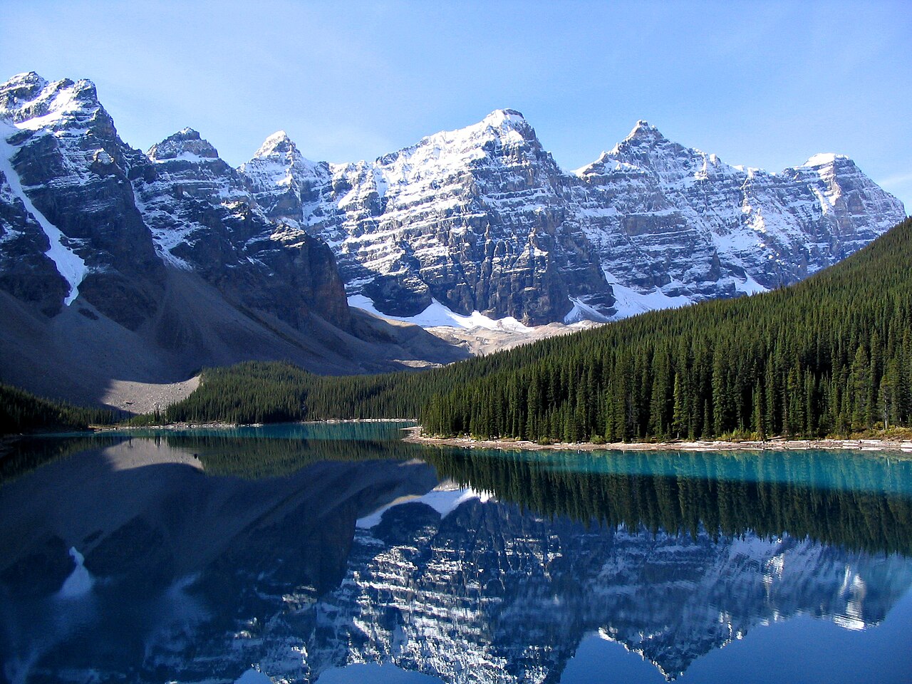

Choose the water-level experience
The Moraine Lake Lakeshore Trail is worth choosing when you want to spend time beside the lake rather than only look down over it from the Rockpile. The two experiences are complementary, but neither replaces the other. At water level, nearby trees, shoreline and changing angles break the familiar broad scene into smaller views. You feel the length of the lake through walking rather than understanding it only as an arrangement in a photograph.
The named shore trail is an out-and-back. Do not assume there is a complete circuit because a mapping application outlines the water on both banks. Your plan is to follow the designated lakeshore path and return along it. This allows you to choose a reasonable turn-back point if your preferred distance is shorter than the entire route. The absence of a circuit is not a disadvantage when a controllable, relaxed outing is the goal.
The start is a trailhead, not the beginning of every photograph
The official route begins just beyond Moraine Lake Lodge. Keep that trail identity separate from the Rockpile path, which occupies a different place within the arrival-area walking choices. A first-time visitor can easily group everything under the phrase Moraine Lake walk, but the scope affects time, surfaces and the type of view. Mark the shore route and its return on your map before choosing optional additions.
Arrival at Moraine Lake has its own arrangements, which should be confirmed directly through official information. Those arrangements are not reproduced here. An allocated travel window needs to contain the experience you actually want, including pauses, rather than only the bare movement along a short trail. Keep the journey to and from the lake separate from the shore trail's walking effort.
What the shore adds beyond the Rockpile
The Rockpile gives the well-known elevated arrangement of water and mountains. The lakeshore supplies changing proximity: trees screen and reveal the scene, the opposite bank shifts in relation to the peaks, and the arrival area gradually feels farther away. If your goal is a single recognisable image, the viewpoint may be enough. If you want to understand the lake as a place rather than a picture, the walking sequence adds value.
This is also a useful distinction for groups. One person may enjoy photographing a broad view, while another values a quiet rhythm of movement and small details along the water. A plan that makes space for both purposes can work better than rushing through both complete routes. Agree how much shore walking you want and allow the path itself, rather than a completion target, to shape the visit.
Pick a modest combination instead of an automatic upgrade
For many visitors seeking a lighter day, the third option is the most coherent. It offers contrast without requiring a larger ascent. Larch Valley or Eiffel Lake can be excellent separate interests, but they should not be attached casually because the shore walk seems short. A path beginning near the same water does not share the same level of effort.
Swipe the table horizontally to compare every column.
| Plan | What it offers | Main limitation |
|---|---|---|
| Rockpile only | The familiar higher viewpoint | Little experience of walking along the water |
| Lakeshore only | A sequence of water-level views | No elevated whole-lake composition |
| Rockpile plus selected shore walking | Contrasting perspectives in a lighter day | Needs enough time to enjoy both |
| A higher route such as Larch Valley | A substantial mountain walking objective | A different commitment from a gentle shore visit |
An endpoint is not an invitation to continue anywhere
Stay within the established route and appropriate shoreline areas. At the far end of a mapped trail, an apparent line between rocks or vegetation is not evidence that the walk continues. A guide should not invent a longer circuit to make the destination sound more substantial. Returning the way you came keeps the chosen activity clear and provides the opposite direction of view across the lake.
Avoid water or rock detours intended to produce a more dramatic photograph. The real landscape is already enough, and the authorised route supplies a range of compositions. A photograph made beyond the path may hide its photographer's circumstances and judgement. It cannot serve as instructions for where you should stand or how you should reach it.
Pace a short walk as a complete visit
A gentle trail can still occupy a rewarding part of the day when you allow time to notice details. Plan a pause, take photographs from suitable points and let the group move at a shared comfortable pace. The useful measure is whether you enjoyed the lake, not how quickly you returned to the starting area. Trying to compress the walk to fit an ambitious wider itinerary can eliminate its main advantage: the chance to slow down.
Consult current Parks Canada information before deciding on the outing for your date, including any conditions or restrictions that affect the shore. This guide makes no all-season access promise. Its lasting recommendation is to choose Moraine Lake Lakeshore for water-level observation, understand the out-and-back shape, and make any higher trail a separate assessed objective rather than an inevitable next step.
Parks Canada's shore listing is 1.3 kilometres one way, with minimal height change and a 45-minute return estimate. A full retraced visit therefore covers 2.6 kilometres before a separately chosen Rockpile walk. Those figures help you choose how to divide a limited lake visit: allow time for the shore sequence if walking beside the water is the priority, or shorten it deliberately when the higher composition matters more. Do not add the full shore outing and the full viewpoint visit while allocating only the shore's walking estimate to the combination. Pauses and the access journey remain additional parts of the day.
Questions answered
Does the lakeshore walk go all the way around Moraine Lake?
No complete lake circuit is part of this guide. Follow the designated lakeshore route and return along it.
Is the shore trail the same as Rockpile?
No. Rockpile supplies a higher viewpoint. The shore trail develops a series of water-level views and is a separate walking choice.
Sources & scope
Route facts are drawn from the resources below. The comparisons and recommendations are our research-based editorial analysis; this is not a claim of personal trail inspection. Access and conditions must be checked with the responsible land manager before travel.
Editorial standards · Explore the destination guides
Found a detail that needs correcting? Send the guide URL and a supporting source so we can review the exact route version.